The road did not exist before 1905. It was agricultural land basically comprising five or fewer fields. Given their proximity to the Common and the sandy soil, the fields were probably used for rough grazing. The land is shown on Nineteenth Century Maps.
TITHE MAP
The earliest Map showing the field boundaries is the Tithe map of 1842. This Map is extremely accurate as it was surveyed to shown the tithe tax amounts due from the landowner to the church based upon the size of holdings. The apportionments show the exact size of the fields, their ownership and their occupancy. The outer boundaries of the fields are precisely the same as the rear boundary gardens of the current properties in Yew Tree Road.

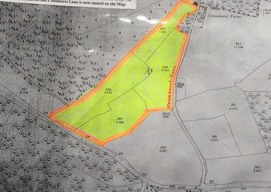
The relevant fields are shown on the Tithe Map as Field Parcels 130, 131, 134, 135 & 137.
The Field Parcels are shown in the Tithe Apportionment as owned by Mary Caroline Smith and occupied by Richard Whitbourn. The former occupied a property on the Petworth Road (A.283) and is still standing and known as St. Patrick’s Lodge and the Coach House (Tithe Parcels 435 & 436). Richard Whitbourn occupied other Field Parcels and is likely to have been a local farmer. The size and shape of the fields do not change on later maps.
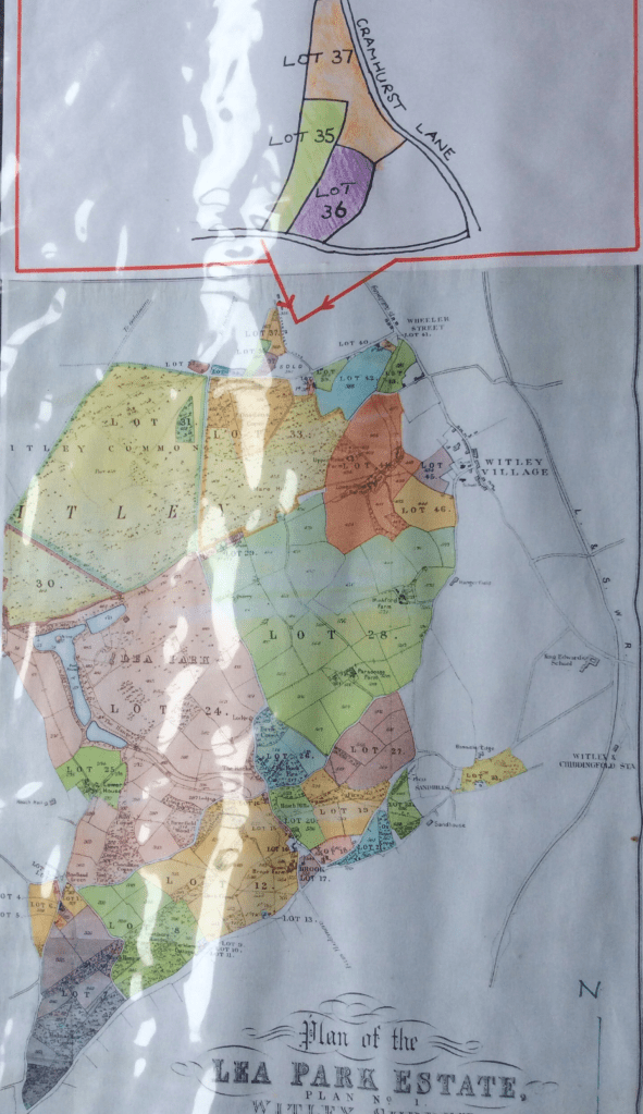
The principal roads in the immediate area are Cramhurst Lane and Gasden Lane/Wheeler Lane. The two red arrows on the plan point to these roads. There are two buildings of significance along Cramhurst Lane – the farmhouse and a cottage which are both still standing although slightly altered.The Haslemere Road (A.286) looks like a track across heathland and has no separate parcel number.
ORDNANCE SURVEY MAPS 1870 and 1897
The Ordnance Survey Maps show the same fields. The 1870 Map shows the parcels as tree-lined but this may simply be decoration. The same roads are shown (unnamed) and the same properties as the Tithe Map. The 1897 Map shows the same field parcels but with different numbering and two of the fields have been combined. Cramhurst Lane is now named. The property known as Gasden is shown in Gasden Lane. Cramhurst Farm is shown on all of the maps as are a pair of cottages (still standing) in Cramhurst Lane. Notice the clump of trees in the middle of the fields.

At some stage, the fields became part of the Lea Park Estate.
WHITAKER WRIGHT
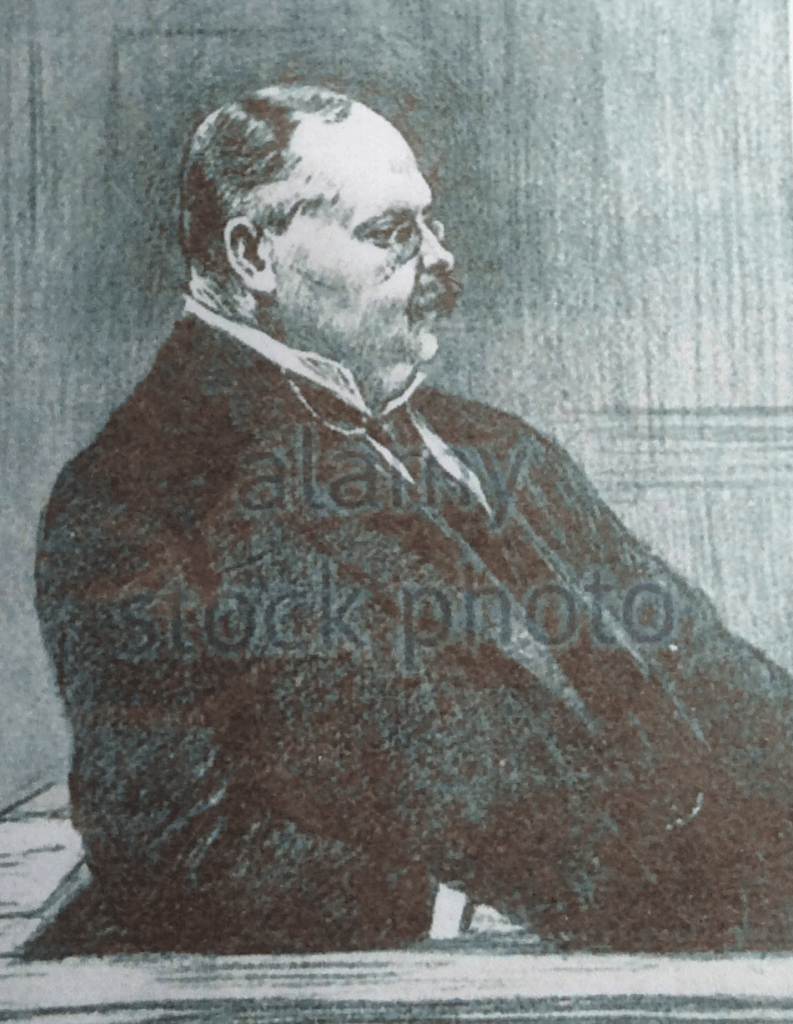
From 1895, Whitaker Wright owned Lea Park (now Witley Park). It comprised virtually all of the land from Wheeler Lane and Gasden Lane in the north through to Sandhills and Park Lane in the south from Wheeler Street and Witley Village in the east to Bowlhead Green in the west. It included Witley Common, Gasden Copse, Mare Hill, Winkford, Parsonage and Bowlhead Green Farms together nearly all of the properties in Brook and those along Park Lane. It was centred on Witley Park which then had a substantial house and grounds. . It was a vast estate. In 1898, Whitaker Wright bought Hindhead, Grayswood and Witley Commons which were still included in the Manor of Witley. This land included these fields.
Whitaker Wright had become a fabulously rich man after making fortunes in America mainly by floating companies exploiting silver mines in Colorado and New Mexico but also dealings on the Philadelphia and New York Stock Exchanges. He returned to England in 1890 and then, during the next decade, made his money on the stock exchange by creating mining companies that owned goldfields in Australia and Canada.
He acquired the estate in 1895 and set about its development. He built a great house at Lea Park by extending significantly the existing property and extensively changing the grounds including the creation of the three large lakes. The boundary wall of the Lea Park and the several gatehouses along the Midhurst Road (A.286) and Lea Coach Road remain.
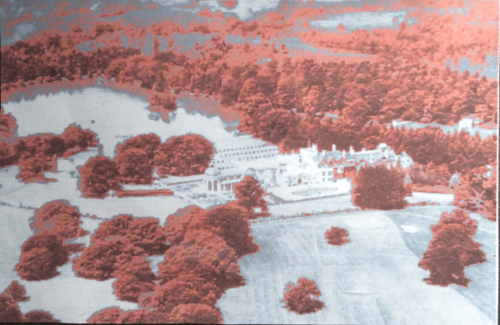
(The House burned down in 1952 but the grounds, wall and gatehouses remain)
At the end of 1900, his companies crashed and on 26 January 1904, he was convicted of falsifying the balance sheets of his principal company. He was sentenced to seven years’ imprisonment but committed suicide the same day. He was buried in Witley Churchyard.
(For more on this larger than life character, read the book ‘The Making of Whitaker Wright’ by Douglas Hamilton available on Amazon).
Whitaker Wright had borrowed heavily against the Lea Park Estate and during March to July 1905, his principal creditor, Sir William Marling, obtained various Court Judgments whereby the estate was ordered to be sold to obtain repayment of the loans.
AUCTION
An auction of the lands was held on 26 October 1905 at Borough Hall in Godalming. The Auctioneers, Hampton and Sons, prepared a map to show the lots. The four fields (now comprising Yew Tree Road) are shown on the Map as Lots 35, 36 & 37 described as plantation, wood and meadow.